California is a land shaped by seismic activity. A history of earthquakes is written in its landscape in the form of rifts, folds, and cracks.
But major tremors also tend to leave less dramatic fingerprints.Amid last week’s Independence Day celebrations, a 6.4 magnitude tremor shook the ground a couple hundred kilometres (about 150 miles) northeast of Los Angeles. A day later, an even bigger one hit, measuring 7.1 on the Richter scale.
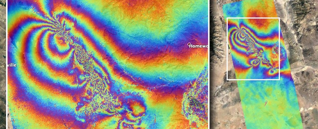
These were two of the biggest quakes the south has seen in decades. It’s not surprising they not only tore apart infrastructure, but also left their mark as ruptures in the planet’s surface.To get a better idea of less obvious changes to the crust caused by the quakes and thousands of their aftershocks, NASA’s Advanced Rapid Imaging and Analysis (ARIA) team used data collected by a synthetic aperture radar, a device that produces high-resolution remote sensing imagery.
READ MORE


Recent Comments